Semuliki National Park is located in Bwamba County, a remote part of Bundibugyo District, in western Uganda. It was made a national park in October 1993 thus making it one of Uganda’s newest national parks.
The 194 sqkm (75 sq mi) park is East Africa’s only lowland tropical rainforest found in the park. Semuliki National Park sprawls across the floor of the Semuliki Valley on the remote, western side of the Rwenzori Mountains. So, the park is dominated by the easternmost extension of the great Ituri Forest of the Congo Basin. This is one of Africa’s most ancient and bio-diverse forests, and one of the few that survived the last ice age, 12-18,000 years ago.
Semuliki National Park Uganda experiences an average rainfall of 1,250 mm (49 in), with peaks in rainfall from March to May and from September to December. Many areas of the park experience flooding during the wet season. The temperature at the park varies from 18 to 30 °C (64 to 86 °F), with relatively small daily variations.
Communities Around Semuliki National Park
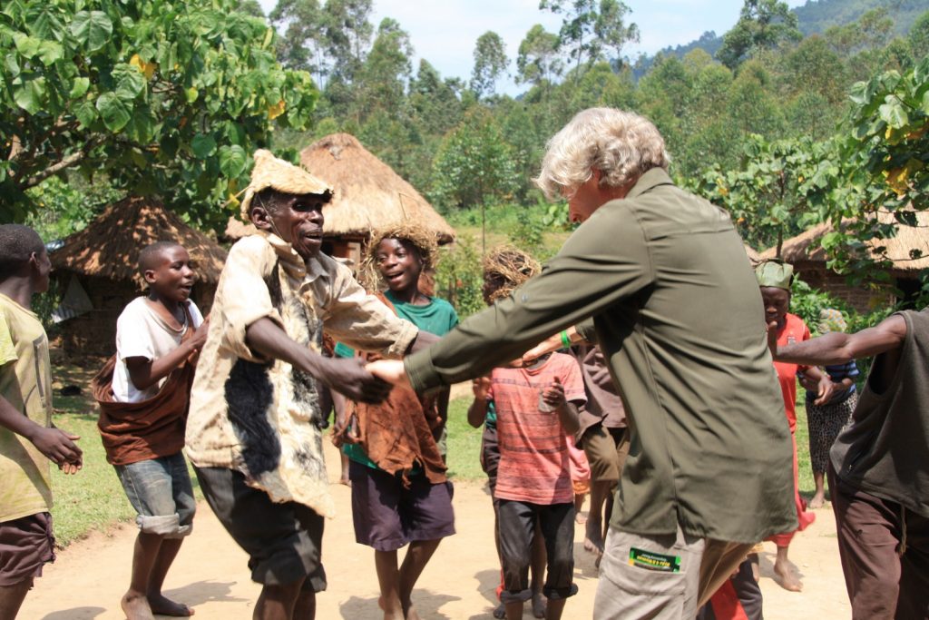
Four distinct ethnic groups live near the park. The Bwamba farmers live along the base of the Rwenzori while the Bakonjo cultivate the mountain slopes. The Batuku cattle keepers inhabit the open plains while the Batwa pygmies stay at Sebitoli since they were resettled out of the park forest. Even though, they still access the park resources because they’re traditionally hunters and gatherers, that’s why they live on the edge of the forest.

It is one of the richest areas with high floral and fauna diversity in Africa, including diverse bird species. The park is managed by the Uganda Wildlife Authority who are in full control of the entire conservation of the park and its activities.
Semuliki National Park Uganda is served by Semuliki River. This 160km long Semuliki River carries runoff from the Rwenzori Mountains to Lake Albert and the Nile. This seems to prove ancient geographers’ claims that the Nile flows (in part anyway) from a snow-capped mountain in the heart of Africa.
Features and Species in Semuliki National Park
The Semuliki Valley contains numerous features associated with central rather than eastern Africa, such as the thatched huts that are shaded by West African oil palms. The Semuliki River, which forms the international boundary, is a miniature version of the Congo River, and the forest is home to numerous Central African wildlife species. The local population however includes the Batwa pygmy community that originated from the Ituri. As a result, this park provides a taste of Central Africa without having to leave Uganda.
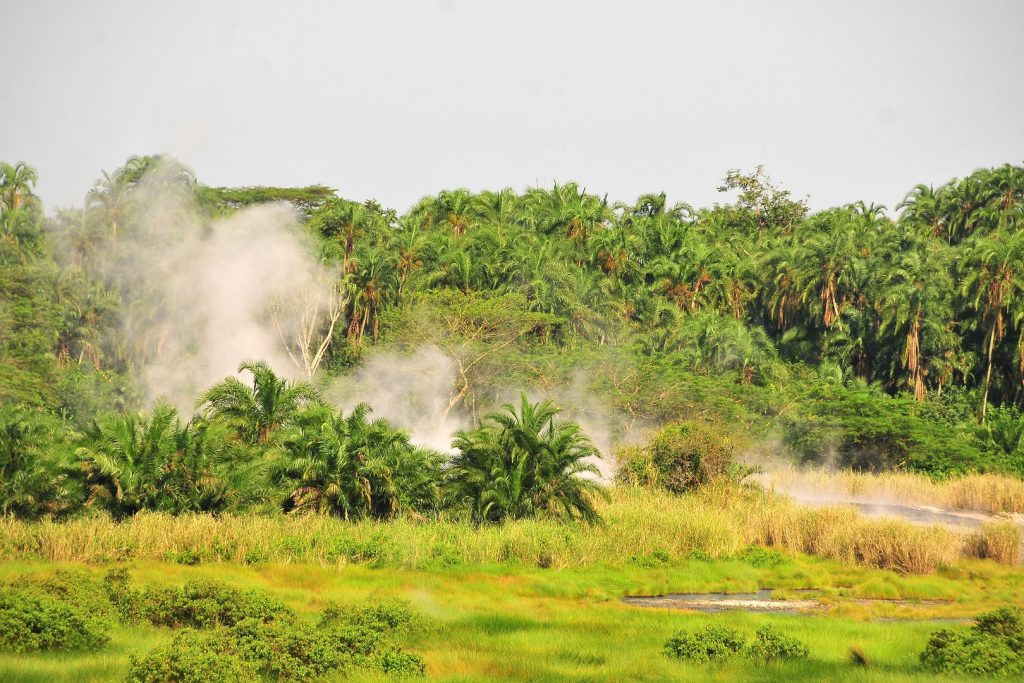
While Semuliki’s species have been accumulating for over 25,000 years, the park contains evidence of even older processes. Hot springs bubble up from the depths to demonstrate the powerful subterranean forces that have been shaping the rift valley during the last 14 million years. Large areas of this low-lying park may flood during the wet season, a brief reminder of the time when the entire valley lay at the bottom of a lake for seven million years.
The area that Semuliki National Park covers is a distinct ecosystem within the larger Albertine Rift ecosystem. The park is located at the junction of several climatic and ecological zones, as a result, it has a high diversity of plant and animal species and many microhabitats. Most of the plant and animal species in the park are also found in the Congo Basin forests, with many of these species reaching the eastern limit of their range in Semuliki National Park.
Birdlife in Semuliki National Park
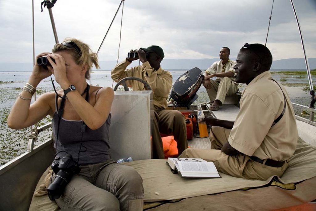
It is the only tract of true lowland tropical forest in East Africa, hosting more than 440 recorded bird species, 9 primates, 336 plant species, 40 of which are restricted in the park. There are also more than 374 species of butterflies and 63 mammals. Semuliki is known as one of the birding destinations and mostly visited for birding as the major activity that brings visitors to the park.
Of the more than 441 bird species, including the lyre-tailed honeyguide, more than 216 of these species, that is 66 percent of the country’s total bird species, are true forest birds. These include the rare Forest Ground Thrush (Turdus oberlaender) and Sassi’s Olive Greenbul (Phyllastrephus lorenzi). Nine (9) species of hornbills have been recorded in the park.
Semuliki National Park has over 63 mammal species, including forest buffalos, leopards, hippos, mona monkeys, water chevrotains, bush babies, civets, elephants, and the pygmy flying squirrel (Idiuus zenkeri). Nine species of duikers are found in the park, including the bay duiker (Cephalophus dorsalis). Semuliki National Park has nine primate species and more than 374 butterfly species.
Activities

Visitors to Semuliki National Park can engage in bird watching, game drives across the Savannah grassland and hiking through the 13 kilometres (8.1 mi) Kirumia Trail. You can also visit the famous hot springs where the water is hot enough to cook eggs and plantain. As of 2016, Semuliki National Park is ranked 68th of 120 things to do in Uganda. This puts it among the must see top safari destinations in Uganda.
Semuliki National Park borders the Semuliki and Lamia Rivers, which are watering places for many animals. The park has two hot springs in a hot mineral encrusted swamp. The male and female hot spring. One of the springs – Mumbuga spring – resembles a geyser by forming a 0.5m high fountain. These hot springs attract a large number of shorebirds and they are a source of salt for many animals as well. Forest buffaloes are always sited coming to leak the salty waters and mud in the area around the hot spring.
In summary, there are quite a number of activities that can be done in the park including: –
- Nature walks which include primate view and hot spring view
- Bird watching
- Safari game drive
- Community encounter
- Hiking
- Boat ride on Lake Albert
- Spot fishing
These have made Semuliki National Park to be one of the unique destinations to visit in Uganda. This is because of the unique activities that can only be done in the park, that lies below the Mountain ranges of Rwenzori and stretch to the valley up to Lake Albert.
